...as in, "tooling around on my bike." Both the Real Doctor and I have had a hard time getting into really good riding shape over the last few years--work getting crazy, or moving, or starting a farm, or health, or my parents' health, it seems like we'll start riding regularly and then something will blow up just as we start getting into shape. Then, after two months of dealing with the crisis du jour, we're back to wheezing through a flat, twenty mile ride and feeling awful.
Well, we're riding more regularly now and have been for the last couple of months. We certainly can't use the excuse that there's no place to ride. Here's some pictures from a ride out our door. At twenty five miles with a bit of climbing, it's a bit long to be quotidian, but short enough to do a couple of times a week.
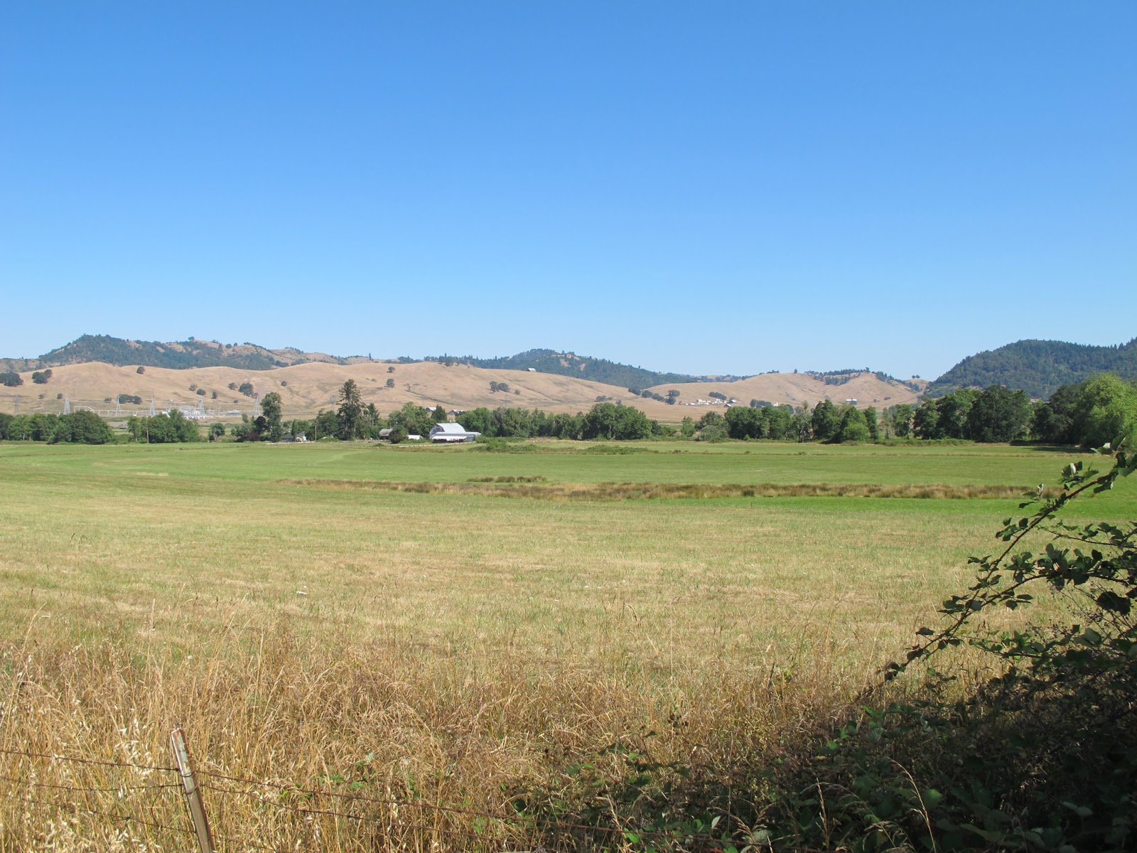
A couple of miles of riding on Hwy 138 takes us over a ridge, and puts us in the valley of the North Umpqua river. There's a bit of flat land in the river valley at this point, with some nice farms; the hills in the background are on the other bank, rising to Mt. Scott and four thousand something feet.
Our ride goes along the North Umpqua for a few miles; we don't need to cross, but the view from the bridge is nice. This is looking east, up the river towards Crater Lake.
And, looking west. The river's kind of low, now, with the dry year. In winter, it's a couple of meters higher. The river flows across sedimentary mudstones, giving a very corrugated bed.
We follow the river to the town of Glide, and the landmark "Colliding Rivers." The mudstone is cut here by a sill of basalt. The North Umpqua flows in from the background of this picture, running along the sill; the Little River, having run into the same sill, flows in from the lower right of this picture. The two rivers collide head-on, and flow out through a narrow chasm at the center left of this picture. In flood, it's a remarkable sight. Our ride leaves the Umpqua, and goes up the Little River for a mile or two. Not shown: a couple of ospreys.
We've left the Little River, and are riding up a tributary creek. The road climbs easily but steadily, through some beautiful farmland. This is looking back towards the Little River...
...and this is looking ahead, to what we'll be climbing over.
The climb steepens considerably, requiring the next-to-lowest gear for a half mile or so; this is looking back, but you can't really see how steep it is.
Here's right near the summit. There's a false summit, a short, fast descent, and then another climb to the real summit. It's right about here, on the descent between peaks, that a yellow jacket flew up my shorts (I was riding a recumbent, wearing baggy shorts) and stung me on the butt. Hazards of riding.
Once over the top, there's a couple of miles of lovely downhill and views. Not shown: the border collie rounding up a herd of sheep, its owner whistling commands.
An inescapable part of the view in Oregon is that the economy is still largely based on extractive industries. A lot of the greenery one sees on the hills is stuff that has been clear-cut and then replanted with monoculture. If you're just tooling along, it's hard to tell the difference--treetops look like treetops, no matter the age--unless you have some way of telling that they're only a couple of meters tall. Or, you can see a clear cut.
The end of the descent drops into another beautiful valley with nice farms; here's looking back to where we rode from, the left background of the photo. Not shown: drivers waving at you. Just about every driver waves, which is disconcerting if you come from California where you typically get other hand gestures.
This is looking ahead. If we kept going straight, this road would join a larger creek and go straight into downtown Roseburg in six or seven miles. However, we're going to go right--to the north--at the base of that brown hill on the right.
Here's a view of where we'll be going--we're going to ride up and over that brown, grassy ridge.
This is the view from the base of that ridge, looking back. The blackberries are starting to come into season!
Riding up the ridge, one is treated to another nice view of another nice valley. This is a gated road; it used to service a timber mill, which is now closed down--another drawback to extractive economies is that they collapse. However, it's a nice (though not maintained) road and has no traffic. Not shown are the lazuli buntings and goldfinches.
We've crested the ridge, and we're looking back at it in the center left of the picture. Riding the gated road has spared us riding up Hwy 138, the large (and relatively busy) road in the center of the picture.
Here we're looking forward from the same spot. We'll continue on Hwy 138. Two miles of downhill will take us into that valley, right to our driveway. A nice ride.
As the Real Doctor has pointed out, it's nice to live in a place you wouldn't mind vacationing. I hope we can keep riding more. We don't have a lot of riding options from our door, but they are all nice--I'll try to put up more pictures of other rides later. Maybe in the spring, when things green up a bit more.


YOU ARE INVITED TO FOLLOW MY CHRISTIAN BLOG
ReplyDelete